“Imagined Regions” exhibit displays rare historical maps from the collection of Simon Burrow, collector and global industrialist. The collection illustrates the historical relationship between Mexico and the United States. Mary Theresa Avila, program coordinator for the ASU School of Transborder Studies talks about the exhibit.
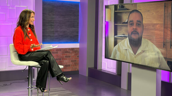
José Cárdenas: "Changing boundaries map exhibit" displays rare historical maps from the collection of Simon burrow, collector and global industrialist. Burrow donated the exhibition to the ASU school of transborder studies. The collection illustrates the historical relationship between Mexico and the United States. Here to talk about this collection is Teresa Avila, program coordinator from the ASU School of Transborder studies. Welcome to "Horizonte." I have had a chance to look at some of the pictures of the maps. They're just fascinating. And they date from what, the 16th century to the 19th?
Teresa Avila: To the present. I think one of the most recent maps in the collection is from the 1980s.
José Cárdenas: Tell us about Simon Burrow and how he put together this collection?
Teresa Avila: Simon was interested in understanding the border lands, the region between U.S. and Mexico, where he had factories on both sides of the border. And he began that collection as a hobby, and used the maps within his space at the factory for dialogue with customers, employees, etc. When he sold the factories, he took the maps on the road and curated an exhibition and toured it around numerous university colleges.
José Cárdenas: And he decided to donate the collection to the school of transborder studies.
Teresa Avila: That's right.
José Cárdenas: You have created a new exhibition, imagined regions --
Teresa Avila: Correct.
José Cárdenas: And it is not the entire collection. There are 120 maps in the collection.
Teresa Avila: Correct.
José Cárdenas: But a portion of them with a particular theme which is what gives rise to the title. Explain that.
Teresa Avila: The theme, imagine regions, speaks to a number of aspects of imagining the Americas and people that live in the Americas and the border lands. In looking at the maps, we designed the exhibition around the idea of imagining the Americas, as explorers discovered and then colonized the Americas and maps were produced to help inform a European audience about this very foreign place. There was a lot of I imagination --
José Cárdenas: These are not maps you would want to take with you into the desert and try to find something.
Teresa Avila: Correct. There was some effort to understand the region and the landscape, but due to issues of access, lack of technology, that was really impossible. There was a lot of speculation on the explorer's part and topographer's part in trying to imagine what this very foreign place was and who lived there and what it looked like and within that there is a lot of stories that also helped to fuel the imagination.
José Cárdenas: We have pictures of several of the maps. First one is perhaps the most speculative. Seven cities of gold reflected on this map
Teresa Avila: That's right.
José Cárdenas: Cities that never existed, of course.
Teresa Avila: In the imagination of many it existed. That story can be traced back as early -- could be said of a number of places, and myths that we're familiar with. Fountain of youth, for instance. Top right corner, you can see seven separate structures, which represent what would be the seven cities. It is actually positioned -- the map itself is a little skewed in perspective. Not a map created on geographical knowledge but speculation likely from the boat looking towards the land. Seems like they're positioning somewhere along Arizona, U.S. Mexico border --
José Cárdenas: And this map dates from 1549 --
Teresa Avila: No, actually from 1597. One of the earliest maps we have. It is rich with that element of mythology and inventiveness and early exploration. It definitely represents that.
José Cárdenas: We've got some other maps we want to put on the screen that indicate in one way or another, variety of different sources. What does this one show?
Teresa Avila: That's actually showing as many of the maps do, the Americas, and different regions. Oftentimes the maps are being produced by different international groups.
José Cárdenas: Yeah, this is in French.
Teresa Avila: Yes, and so you will have the French powers coming in and competing with the British powers, Russia is represented at times, which is kind of an interesting element. You would always hear about Russia's presence in exploration. All of the international players involved in trying to lay claim to the land and that you will have efforts in making these maps rather documentary of what they claim to hold and what they claim to have seen and know.
José Cárdenas: This map is a piece of art really in many ways.
Teresa Avila: Yes.
José Cárdenas: What does it show?
Teresa Avila: This map is one of the rare maps that we have in the collection that incorporates figures, and so you have the map in the middle that shows the Americas, and then the artist has attempted to reflect some of the many elements that you will find, people, flora, fauna, you have animals, vegetation, and an effort to represent different groups based on class and the way they're dressed and it's just a really wonderful representation that relates really to the tradition of -- representing people from the Americas for a European audience.
José Cárdenas: This one dates from the early 1700s. But it is about 100 years after the last one -- the first one we saw. It looks much more representation. That looks like a relatively accurate map of the Americas.
Teresa Avila: Some will be more seemingly accurate than others. And what's interesting, you will have all of these international players representing the Americas, but they're not sharing information, and, so, what one country knows about the region, because they have actually been there and have been able to geographically become familiar with the space, that information is not necessarily shared, and, for instance, there is great speculation that California is an island in the 18th century, and some folk know that California that is not an island and represented as a peninsula in maps, yet you have a wide proliferation of maps that show something otherwise. The maps are wonderful in terms of understanding knowledge production. Many of the maps were circulated in atlases and produced for them. It allows us to remember to question our knowledge and sources of knowledge.
José Cárdenas: This map looks much more current than any of the other ones we saw.
Teresa Avila: It is from the 19th century, mid-19th century. This map produced by a capitalist interested in establishing routes for transport, steamship routes and actually the gentleman involved in the production of this map is involved with the pony express. Part of his company's attempt to get that job, that opportunity to produce modes of transportation, both for mail and people. And so what's interesting about this map, it does show speculation of Arizona and New Mexico in terms of a stacked relationship, as opposed to being side by side. Many of the maps represent the inventive nature of map-making.
José Cárdenas: One last map to put up on the screen and talk about. Is this one that shows California as an island?
Teresa Avila: It does not. What is nice about this map is that it highlights the native American populations. What we like to call transborder communities at the school of transborder studies. Many of the maps document the presence of not only native American groups but missions, explorers, and the maps helped to relate the idea of transporter communities interacting historically which allows us to talk about the same interactions in the present. That is the goal of the maps in the exhibition, to engage in a dialogue about open borders, movement, natural movement of people, and, you know, promote a cooperative space where people exchange and share resources.
José Cárdenas: And how long is the exhibition going to be on display?
Teresa Avila: The exhibition is on display until March 12th.
José Cárdenas: At the Mexican consulate?
Teresa Avila: At the Mexican consulate. And we are willing and available to conduct tours for the public. If anyone is interested in doing that, they can contact us. And let us know they're interested in the tour. Welcome to do small groups, large groups, and educational groups to share the maps.
José Cárdenas: One last question. What is on exhibition, exhibit, is a small portion, about what 20 maps?--
Teresa Avila: 20 maps.
José Cárdenas: What are you going to do with the rest?
Teresa Avila: We've digitized the maps. We're looking to create interactive web maps. We are interested in taking the maps out into the communities. For instance, we can take a group of maps to the heard museum possibly or where native American groups might be able to come and talk to the maps, critique the maps. We can talk about the value they see in the maps and how the maps relate to spatial ideas today. There is a lot of opportunity. We're seeking to utilize the maps as part of our broader project and understanding the border lands, understanding border zones and have a dialogue around natural movement, cooperative space, sharing resources, and understanding the very historical nature of that reality.
José Cárdenas: Let us know when you get to that stage and we will have you back to talk about it.
Teresa Avila: Wonderful.
José Cárdenas: Thank you for joining us.
Teresa Avila: Appreciate it. Thank you.
Mary Theresa Avila:Program Coordinator, School of Transborder Studies at Arizona State University;
