It appears the impact of the El Nino weather pattern was minimal. Randy Cerveny, an Arizona State University climatologist, will discuss the impact of El Nino.
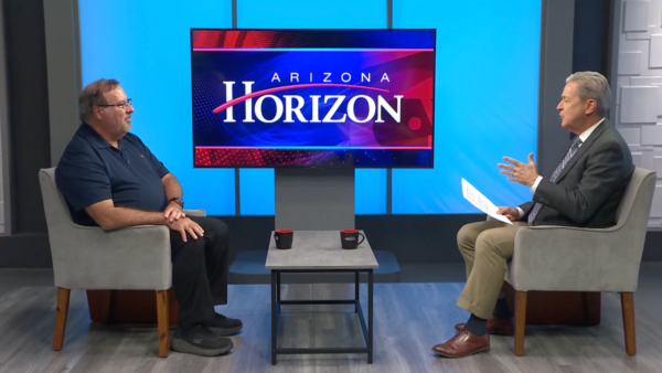
Ted Simons: The El Niño weather pattern that was expected to hit Arizona with above average rainfall this winter was a bit of a disappointment to those hoping for relief from the state’s drought. Here to tell us what happened to El Niño is ASU climatologist Randy Cerveny. What happened to El Niño?
Randy Cerveny: Well, that was the question we have been asking because it’s been trying for the last nine months to get up to the level of what we call El Niño. It’s a warming of the Pacific Ocean. The temperatures of the Pacific Ocean have just been right below that flesh hold we call El Niño for the last nine months. This last month it finally got up so now officially this last month, we are now in El Niño.
Ted Simons: OK. So when it forms this lace or later than use does that make for a different El Niño?
Randy Cerveny: Yeah, it does. What we depend on here in Arizona in particular is the winter storms. And so we are already past that time frame. So the kind of El Niño enhanced rainfall that we are going to get over the next three months and that’s what we are anticipating is that the spring is going to be a little wetter here, but we don’t get much rainfall in the spring anyway. So above normal in the spring means maybe one or two extra storms that we would otherwise have missed.
Ted Simons: As far as winter is concerned how much rain was expected? How much fell in general terms?
Randy Cerveny: Well, here in Arizona we did pretty good. We actually improved our drought situation. This time last summer or at the start of summer, the whole state was pretty much in exceptional drought. We have gotten enough rain that while we are still in drought we are not in exception Al drought. The place that missed any kind of storms this past winter has been California. We got a lot of storms that they simply missed in entirely.
Ted Simons: If this were a regular El Niño they would have gotten some storms. Correct?
Randy Cerveny: Right. You might even hear of something called the pineapple express.
Ted Simons: Yes.
Randy Cerveny: During the El Niño situation, normally storms will come in from the Pacific, and go into California, and then work their way into Arizona during wintertime. And this year, they kind of more came up from — the moisture came up from the gulf of California instead of the Pacific. They got it. We missed it.
Ted Simons: It seemed like we didn’t have much in the way of storms but they dumped a lot when they were here and they call seemed to be coming up from the south.
Randy Cerveny: Right. Right. That’s been because of this odd situation where we have some. Characteristics of El Niño going on but we didn’t have the full blown thing. So the typical kind of wind patterns that would have forced those storms to go through California simply weren’t there.
Ted Simons: Is it unusual to have a late-forming El Niño like this?
Randy Cerveny: Well, every time we have El Niño we learn something new.
Ted Simons: Yes.
Randy Cerveny: We haven’t had one that’s been like this in the last 30 to 40 years we have been studying this. I imagine a lot of scientists over the next few years willing looking to find out what happened to cause this thing to slow down and not form as fast as we thought.
Ted Simons: But technically if we do get some rain now into April, that will be considered part of El Niño?
Randy Cerveny: Yes, yes. Because El Niño doesn’t have to do with rainfall. It has to do with what the temperatures are in the Pacific Ocean and this last month they finally got to the point where they are warm enough we call it an El Niño.
Ted Simons: Do we know if late-forming El Niños mean another El Niño next year? Or a La Nina next winter? Have we gotten that far on this yet?
Randy Cerveny: No. That’s part of the problem. In general, El Niños only last a year or so. Back in the early ’90s we had a sustained El Niño that lasted four years and that was pretty bizarre. But normally they only last about a year. So if it starts now, it may go into a little bit of the wintertime for next winter but primary impact probably is going to be this summer.
Ted Simons: In general you mention pineapple express, El Niño, this is coming from the tropics and those sorts of things. Does that usually mean less in the way of snowfall? How does that work? You think of warmer storms not so much snow.
Randy Cerveny: Yeah. That’s exactly it. When the storms come in from the equatorial region, the moisture or the air is a lot hotter than it would be if it came down from, say, Oregon and Washington and slipped down into our area. So usually when we get these kind of tropical driven storms they are not going to create a lot of snow cover. That’s something we do like to have but that’s kind of pattern doesn’t favor that.
Ted Simons: And we didn’t get much snowpack this year.
Randy Cerveny: Exactly.
Ted Simons: As far as the forecast is concerned, let’s talk about precipitation. I know you have a little map here that shows the next couple of months or so regarding this extended El Niño. What are we looking at here?
Randy Cerveny: This is what the climate prediction center which is a part of the National Weather Service, says is our likelihood for rainfall over the next three months. We are looking at primarily April, May, and June. And what we see is that our area, the Southwest, is going to get above normal precipitation as well the Southeast. Now, the problem for us is above normal precipitation this time of year is not very much.
Ted Simons: Right.
Randy Cerveny: Like I say we might get one or if you more storms but that’s going to be about it.
Ted Simons: As far as temperatures are concerned for the next few months, what are you seeing there?
Randy Cerveny: Well, the other thing is that generally, the western part of the country has — for a long period of time, above normal temperatures. That’s basically what they are forecasting for the next three months is that particularly the California, the West Coast area, is going to be well above normal and they are not going to get any rain. So their problems over the next three months will be even more compound.
Ted Simons: I was going to say, we are talking serious problems in California. Aren’t we? That drought, no help this winters. You look at map there. It’s worse there than almost everywhere eastern Alaska. That’s tough stuff.
Randy Cerveny: That’s right. Of course, we have to keep in mind that has some relation to us because both California and Arizona take a lot of our water from the same course, the Colorado, and they have the first rights on that river.
Ted Simons: As far as drought in Arizona, we are not out of the woods by any stretch, are we?
Randy Cerveny: No, we are not. But on the nice side of the weather coin, I guess, if you will, our monsoon this year will look to be a little bit above normal. The forecast that we are seeing for the next monsoon of July, August, and September, is showing actually above normal rainfall for our particular area.
Ted Simons: That’s interesting. Because we have you here quite a bit. And every time we are here, we have you here, I ask, can you predict the monsoon? And you say no. Now, how come all of a sudden you are predicting a monsoon?
Randy Cerveny: Well, the logic behind this kind of makes sense. We are into El Niño so we are going to get tropical moisture, humidity coming up into Arizona. Well, the things that happens with our monsoon if we warm up enough that tropical humidity gets uplifted and created into thunderstorms. So the reasoning of the climate prediction center if we have El Niño going on it’s going to be funneling more humidity into the area, Arizona at least should get more rain. Doesn’t mean California will because they don’t get as hot as we do but if we get the hot temperatures and humidity coming up we’ll have more thunderstorms.
Ted Simons: So basically, one thing about those higher than average temperatures, it’s a higher than average chance you might get some more storms because of that lifting.
Randy Cerveny: Exactly.
Ted Simons: Before you go, El Niño, we talked about it. We know what happened. Did we learn anything by this?
Randy Cerveny: Well, we learned that we still have a lot to learn about weather is what it comes down to. The one thing that is always interesting is that we seem to have a pretty good idea that once these things start to happen, what’s going to be the eventual result? The trouble with El Niño it never really got happening so we were ready for the forecast once it happened, but it never got there until last month.
Ted Simons: All right. We will see what, we will have you back before the monsoon starts and I will ask you once again and you will tell me what a ridiculous question it is. Thanks for being here.
Randy Cerveny:Climatologist, Arizona State University;